


Le relais du Mont du Chat

PhilippeC54
User
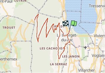

Length
32 km

Max alt
1493 m

Uphill gradient
1310 m
Km-Effort
50 km

Min alt
234 m

Downhill gradient
1309 m
Boucle
Yes
Creation date :
2022-06-07 06:44:06.82
Updated on :
2022-06-07 09:13:06.758
2h19
Difficulty : Difficult

FREE GPS app for hiking
 SityTrail
IGN / Geographical institutes
SityTrail Plus
The world is yours!
About
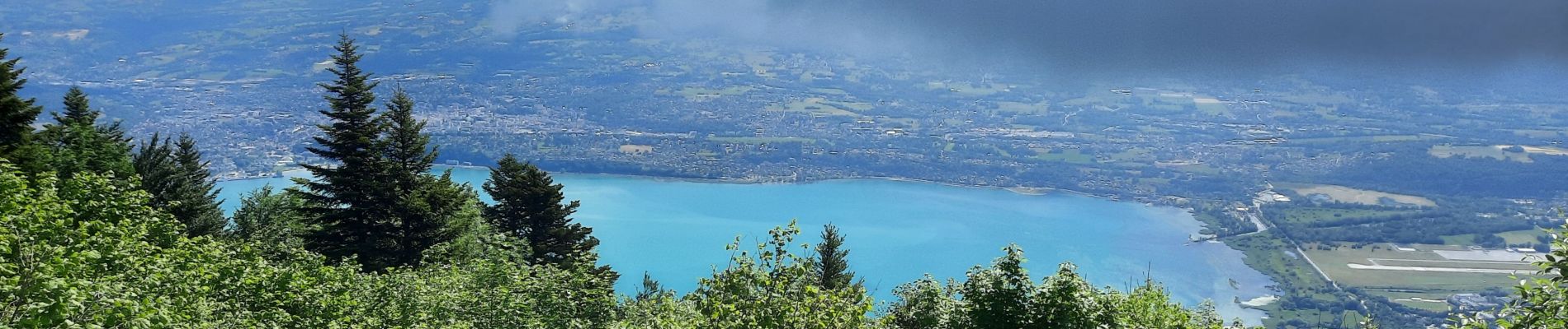
Trail Road bike of 32 km to be discovered at Auvergne-Rhône-Alpes, Savoy, Le Bourget-du-Lac. This trail is proposed by PhilippeC54.
Photos


Positioning
Country:
France
Region :
Auvergne-Rhône-Alpes
Department/Province :
Savoy
Municipality :
Le Bourget-du-Lac
Location:
Unknown
Start:(Dec)
Start:(UTM)
723053 ; 5059500 (31T) N.
Comments